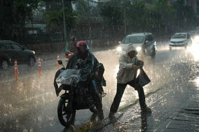
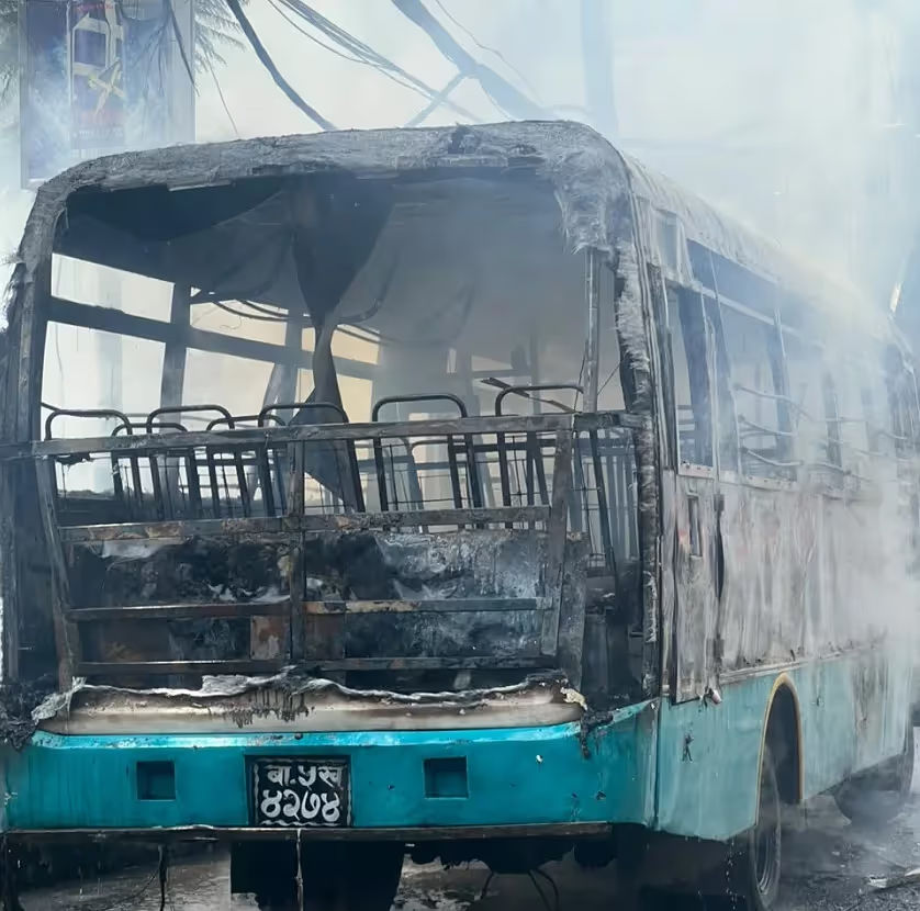
Four Days, 542 Disasters: How Nepal’s September Rain Turned Mountains and Rivers Into a Nationwide Emergency
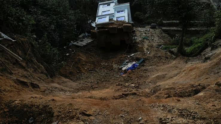
Four days of relentless rainfall across Nepal have produced a nationwide trail of landslides, floods, damaged homes, blocked highways and emergency evacuations. Between September 24 and 27, authorities recorded 542 rain-related disaster incidents, leaving 27 people dead, four missing and eight injured.
The figures released by the National Disaster Risk Reduction and Management Authority (NDRRMA) show that the damage was not concentrated in a single district or river basin.
From the mountains of Manang and Mustang to flood-prone settlements along the Narayani, the prolonged rainfall disrupted communities and transportation across multiple parts of the country.
The scale of the four-day emergency: NDRRMA recorded 304 landslide incidents, 87 flood incidents and 151 other incidents linked directly to heavy rainfall between September 24 and 27. Together, they affected 1,082 families, destroyed 227 houses completely and damaged 142 more.
Landslides Accounted for Most of the Deaths
Landslides were the deadliest category of disaster during the four-day period.
NDRRMA recorded 304 landslide incidents across Nepal. They were responsible for 20 deaths, while four people remained missing and seven were injured.
Floods accounted for another 87 incidents and four deaths.
A further 151 incidents were classified as heavy-rainfall-related events, resulting in three deaths and one injury.
Rainfall Reached Extraordinary Levels
The disaster figures came after exceptionally heavy rainfall was recorded at monitoring stations across the country.
More than 100 millimetres of rain was recorded at 186 rainfall measurement stations during the four-day period.
The highest total was measured at Dedhgaun in Nawalparasi East, where rainfall reached 544.2 millimetres.
Panchase in Kaski recorded 500.2 millimetres, while Atraulitaar in Tanahun received 472 millimetres.
The Numbers Behind the Disaster
- 542 rain-related disaster incidents
- 27 people killed
- 4 people still missing
- 8 people injured
- 304 landslide incidents
- 87 flood incidents
- 151 other heavy-rainfall incidents
- 1,082 families affected
- 227 houses completely destroyed
- 142 houses partially damaged
- 31 bridges damaged
- 114 livestock killed
Why Did So Much Rain Fall?
According to NDRRMA, the heavy rainfall was associated with a low-pressure system that developed over the Bay of Bengal.
The weather system brought prolonged rainfall to different parts of Nepal, with particularly intense precipitation recorded across several areas of the country's hills and plains.
The prolonged nature of the rainfall was particularly dangerous because saturated slopes became increasingly vulnerable to landslides while rivers and smaller streams continued rising.
The Crisis Was Already Being Forecast
The rainfall did not arrive without warnings.
Nepal's Meteorological Forecasting Division had warned on September 24 that heavy to very heavy rainfall was possible in parts of Koshi, Bagmati, Gandaki and Lumbini provinces, with heavy rainfall also possible at some locations in Madhesh.
Forecasts for the following days continued to indicate heavy to very heavy rainfall in several provinces, with extremely heavy rainfall possible at isolated locations in Gandaki and Lumbini.
The warnings became particularly important as the rainfall persisted rather than passing through quickly.
Nearly One Million People Received Flood Warnings
NDRRMA said it intensified preparedness measures before the rainfall began.
Its situation room monitored weather and disaster risks continuously for approximately 76 hours.
Through telecommunications providers, flood-warning SMS messages were sent to more than 980,000 people.
The authority also provided weather and disaster-risk information to thousands of responders and tourists.
Flood Forecasting Was Extended
NDRRMA said flood forecasting for major rivers had been extended from three days to five days.
For flash floods in smaller rivers and streams, the forecasting window was increased from 24 hours to 48 hours.
The changes were intended to provide authorities and communities with more time to prepare for rising water levels and possible evacuations.
Around 2,000 People Were Moved to Safety
Early warnings were followed by evacuations as conditions deteriorated.
NDRRMA spokesperson Shanti Mahat said approximately 2,000 people at risk from floods and other rain-related disasters were relocated to safer areas.
Helicopters were used to reach people stranded by floods and landslides in remote parts of Jajarkot, Myagdi and Baglung.
Nepal Police, the Armed Police Force and the Nepali Army were deployed for search, rescue and relief operations.
78 People Were Airlifted From Myagdi
One of the notable rescue operations took place in Myagdi.
On September 27, 78 people at risk in Pauddhar of Annapurna Rural Municipality-5 were airlifted to safety.
Four people stranded on an island in the Bheri River in Jajarkot were also rescued by helicopter.
The rescues demonstrated the difficulty of reaching communities after roads and bridges were damaged or blocked by landslides and flooding.
Major Highways Were Disrupted
The rainfall created a major transportation problem across Nepal.
Landslides blocked sections of the Narayangadh–Muglin road and the Prithvi Highway.
Other disruptions were reported along the Karnali Corridor, Karnali Highway, Mid-Hill Highway and Rapti Highway.
Roads connecting Surkhet, Salyan, Jajarkot, Jumla and Mugu were also affected.
Several sections of the Kaligandaki Corridor and other mountain roads were similarly disrupted.
Why road damage matters: In mountainous Nepal, a single landslide can do more than slow traffic. It can cut off communities, prevent emergency vehicles from reaching affected areas and interrupt the movement of food, fuel and other essential supplies.
Bridges Were Swept Away
Floodwater and river erosion also damaged bridges.
NDRRMA reported damage to 31 bridges during the four-day period.
In Myagdi, the swollen Kaligandaki River swept away a motorable bridge connecting Pokharebagar in Annapurna Rural Municipality-6 with Naulibagar in Ward 2.
Another bridge linking Mirmi in Syangja with Harmichaur in Gulmi was also washed away.
The Kaligandaki A Hydropower Project Was Affected
Rising river flows also disrupted hydropower operations.
At the Kaligandaki A Hydropower Project, all gates were opened following heavy inflows, temporarily halting electricity generation.
The disruption came as other hydropower facilities and transmission infrastructure faced pressure from flooding and landslides.
The consequences therefore extended beyond damaged houses and roads to Nepal's electricity infrastructure.
The Narayani River Crossed Its Danger Level
One of the most closely watched rivers during the rainfall was the Narayani.
At Devghat in Chitwan, the river reached 10.11 metres.
Its danger level at that location is 9 metres, while the warning level is 7.3 metres.
Water entered some settlements in Bharatpur Metropolitan City, while communities living close to the river were warned to remain alert and move to safer areas if necessary.
Chitwan Communities Faced Rising Water
The Riu River at Bankatta also exceeded its danger level.
The river reached 4.62 metres against a danger level of 3.80 metres before beginning to decline.
Authorities warned riverside communities as rainfall continued and river levels remained a concern.
Homes Were Submerged Across Multiple Provinces
Flooding affected settlements from the western plains to central Nepal.
In Rupandehi, the Tinau River swept away six houses in Butwal-11, although no casualties were reported in that incident.
In Nawalparasi East, flooding from the Narayani affected settlements including Botetole in Gaindakot.
Parts of Amaltari in Kawasoti were also inundated.
In Saptari, floodwater affected approximately 500 houses and more than 2,000 people in Hanumannagar Kankalini Municipality and Tilathi Koiladi Rural Municipality.
Four People Remained Missing
While 27 deaths had been confirmed for the September 24–27 period, four people remained missing.
All four missing people were associated with landslide incidents, according to the NDRRMA breakdown.
The number highlights another difficulty in disaster reporting: casualty figures can change as rescue teams reach remote locations and authorities receive new information.
The Death Toll Was Spread Across Different Disaster Types
The NDRRMA data provides a clearer picture of how the deaths occurred.
- Landslides: 20 deaths from 304 incidents.
- Floods: Four deaths from 87 incidents.
- Other heavy-rainfall incidents: Three deaths from 151 incidents.
This means landslides were responsible for the largest share of fatalities during the four-day period.
More Than 1,000 Families Were Affected
The disaster incidents affected 1,082 families.
The damage ranged from destroyed houses to partial structural damage, loss of livestock and disrupted access to roads and bridges.
NDRRMA reported that 114 livestock were killed during the four-day period.
For rural households, losing livestock can create a second economic shock after a flood or landslide has already damaged homes and farmland.
Manang and Mustang Faced a Different Kind of River Risk
Heavy rainfall did not simply cause rivers to rise.
In some mountain areas, landslides partially blocked the rivers themselves.
In Chame, Manang, a landslide on September 27 disrupted the flow of the Marsyangdi River.
Another landslide blocked the Kaligandaki River in Thasang Rural Municipality-3 of Mustang.
Such blockages can create a dangerous secondary threat: water accumulating behind debris before suddenly breaking through and sending a surge downstream.
Authorities Warned Downstream Communities
Following the river blockages, NDRRMA alerted officials and local governments in downstream areas.
Authorities were asked to maintain high alert and evacuate vulnerable families if conditions deteriorated.
The warning was particularly important for communities living along lower riverbanks where people may have little time to respond to sudden changes in river flow.
The Rain Was Beginning to Ease by September 28
NDRRMA said water levels in major rivers, including the Narayani, began gradually decreasing from September 28.
The overall flood situation was consequently moving toward normal conditions.
But the improvement did not immediately eliminate the risks.
Saturated hills can remain unstable after rainfall ends, while blocked roads and damaged bridges can continue to isolate communities for days.
Why the emergency does not end when the rain stops: Floodwater may recede quickly, but landslide-prone slopes, damaged infrastructure, blocked roads and unstable river channels can continue creating hazards after the weather improves.
Nepal's Roads Are Especially Vulnerable During Prolonged Rain
Nepal's geography makes transportation particularly exposed to extreme rainfall.
Major highways frequently run alongside steep hills and rivers.
When slopes become saturated, landslides can bury roads with little warning.
When rivers rise, bridges and road sections close to riverbanks can be undermined by erosion.
The September rainfall demonstrated both risks at the same time.
The Disaster Was National, But Its Impact Was Local
The national statistics — 542 incidents, 27 deaths and more than 1,000 affected families — describe the scale of the emergency.
But each incident represented a different local crisis.
For one family, it meant losing a house.
For another, it meant being stranded on the wrong side of a destroyed bridge.
For a farmer, it could mean losing livestock.
For a remote community, it could mean waiting for a helicopter because the road had disappeared beneath a landslide.
The Warning System Reached Hundreds of Thousands
One of the notable aspects of the response was the scale of the warning operation.
More than 980,000 people received flood-warning messages through telecommunications networks.
The system also provided information to thousands of people involved in disaster response and approximately 9,000 tourists.
Early warnings cannot prevent rainfall, floods or landslides, but they can create valuable time for people to move away from exposed areas.
The Biggest Challenge Now Is Recovery
As rainfall decreases and rivers recede, Nepal moves from emergency response toward recovery.
That phase can be slower and more complicated than the rescue operation itself.
Roads have to be cleared.
Bridges need inspection and repair.
Damaged homes require assessment.
Displaced families need temporary shelter and essential supplies.
Hydropower and electricity infrastructure must be checked before normal operations can resume.
What the Four-Day Disaster Reveals
The September rainfall offers a stark illustration of how quickly several natural hazards can interact.
Heavy rainfall saturated slopes.
Saturated slopes triggered landslides.
Landslides blocked roads and, in some areas, rivers.
Rivers carrying enormous volumes of water flooded settlements and damaged bridges.
The result was not one disaster but hundreds of interconnected emergencies occurring across the country at the same time.
A Disaster Measured in 542 Incidents
The number 542 is perhaps the clearest way to understand the scale of what happened between September 24 and 27.
Twenty-seven people lost their lives.
Four remained missing.
More than 1,000 families were affected.
Hundreds of homes were damaged or destroyed.
Bridges disappeared or were damaged.
Highways were blocked.
Rivers rose beyond danger levels.
And thousands of people had to be moved away from danger.
By September 28, the major rivers were beginning to recede, giving Nepal a temporary window to assess the damage and begin rebuilding.
But the experience of those four days is another reminder that in a mountainous country exposed to intense rainfall, the danger does not come from water alone. It comes from what water does to the ground, the rivers, the roads and the communities built around them.
Keywords:
Related Posts