Thunderstorms in Milan to Give Way to Summer Heat as Temperatures Near 30°C
Milan Weather Update: Thunderstorms to Hit the City Before Summer Heat Pushes Temperatures to 30°C
Milan Set for a Week of Two Different Weather Phases
Milan is expected to experience a week of sharp weather contrasts, beginning with unstable conditions and ending with a clear taste of summer. The new week has opened under the influence of a modest weather disturbance that is bringing clouds, humidity, rain and possible thunderstorms to the city. However, this unsettled phase is expected to be short-lived. After Monday’s rain and storm risk, weather conditions are likely to improve gradually from Tuesday, with clearer skies, drier air and rising temperatures. By the end of the week, Milan could see daytime highs close to 30°C, marking a sudden shift from spring instability to early summer warmth.
Monday Begins With Variable Weather
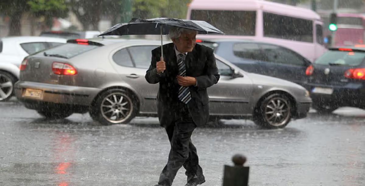
The first part of the week is expected to remain changeable. Monday is likely to bring alternating cloudy and brighter spells across Milan. During the afternoon, residents may still see some sunny breaks, but atmospheric pressure is expected to fall gradually. This drop in pressure will allow more humid air to enter the region, creating the conditions for rain and storm activity later in the day. The latest forecast also showed rain in Milan on Monday, with temperatures around 18°C at the time of observation.
Rain and Thunderstorms Expected After Sunset
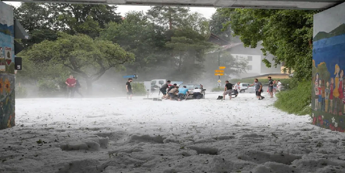
The real deterioration in weather conditions is expected during the evening hours. Clouds are likely to become thicker after sunset, with skies turning cloudy or very cloudy over the city. Rain and showers are expected, and some of these showers may take on a thunderstorm character. Around 10 millimetres of rainfall could fall in parts of the area, according to the forecast mentioned in the report. While this is not an extreme amount of rain, it may still be enough to affect evening travel, outdoor plans and traffic conditions in the city.
Temperatures Remain Mild Before the Heat Arrives
Monday’s temperatures are expected to remain relatively mild and controlled compared with the heat forecast for later in the week. The maximum temperature is expected to stay close to 21–22°C, while the minimum may fall to around 10–14°C depending on local conditions. This means the day will not feel particularly cold, but it will also not yet bring the summer-like warmth expected in the coming days. The combination of humidity, cloud cover and evening rainfall may make the weather feel cooler and more unsettled, especially after sunset.
Winds to Shift During the Day
Winds are also expected to change direction during Monday. In the morning, light winds from the north-northeast may be present, but during the afternoon they are expected to turn from the southwest and become moderate. This change in wind direction is part of the wider atmospheric shift that will bring more humid and unstable air into the Milan area. As the evening progresses, the arrival of clouds and rain may make conditions feel more unsettled across the city and surrounding areas.
Weather Warning in Lombardy
Although the original report said that no alert was present at that time, the latest available forecast information shows a yellow warning for thunderstorms in Lombardy until early Tuesday morning. A yellow warning generally means that people should remain aware of possible weather disruption, especially for outdoor activities and travel. It does not necessarily indicate severe danger everywhere, but it does suggest that thunderstorms could cause local inconvenience in some places.
Improvement Expected From Tuesday
The unsettled weather is not expected to last long. From Tuesday, conditions in Milan should begin to stabilise. The rain and thunderstorms forecast for Monday evening are likely to move away, allowing drier and calmer weather to return. Tuesday may still bring some clouds, but the overall picture will be more pleasant than Monday. Temperatures are expected to rise slightly, with a forecast high of around 23°C.
Anticyclone to Bring Warmer and Drier Conditions
The main reason behind the improvement is the strengthening of an anticyclone. An anticyclone is a large area of high atmospheric pressure that usually brings stable, dry and warmer weather. As this high-pressure system becomes stronger over northern Italy, it will gradually push away unsettled conditions and allow sunshine to dominate. This will mark the beginning of a clear weather change for Milan, moving the city from rain and thunderstorms towards dry and summer-like conditions.
Temperatures to Rise From Midweek
From Wednesday onwards, temperatures are expected to increase noticeably. The weather will become more stable, and the thermometer may climb to around 27°C on Wednesday. By Thursday, the maximum temperature could rise further to nearly 29°C. This will make the second half of the week feel much warmer than the beginning. Residents may notice a clear difference between Monday’s wet and unstable conditions and the warmer, brighter weather expected later in the week.
Weekend Could Bring First Real Taste of Summer
The most summer-like conditions are expected towards the weekend. Forecasts indicate that Milan could reach around 30°C from Friday through Sunday. Friday is expected to be sunny to partly cloudy and very warm, while Saturday and Sunday may bring similar conditions with highs near 30°C. This would give the city one of its first real tastes of summer weather, especially after a spring period marked by variability and occasional instability.
Outdoor Plans Likely to Improve After Monday
For people planning outdoor activities, the best weather window will likely open from Wednesday onwards. Monday evening may not be ideal for outdoor dining, walking, sports or events due to showers and possible thunderstorms. Tuesday should already be more stable, but the clearest and warmest conditions are expected in the second half of the week. Parks, open-air restaurants, terraces and shopping streets may become busier as temperatures rise and sunny weather returns.
A Sudden Shift From Spring to Summer
The weather change expected in Milan reflects a common seasonal pattern during late spring. Short-lived disturbances can still bring rain and thunderstorms, but stronger sunshine and high-pressure systems can quickly push temperatures upwards. In this case, Milan may move from a rainy Monday evening to summer-like heat within just a few days. This sudden contrast may make the week feel divided into two completely different phases.
Residents Advised to Stay Updated
People in Milan are advised to keep an eye on updated weather forecasts, especially on Monday evening when showers and thunderstorms may occur. Those travelling by car, bike or public transport should be prepared for wet roads and possible delays. After the unstable phase passes, attention may shift to the warmer weather later in the week. With temperatures close to 30°C, residents may need lighter clothing, sun protection and more attention to hydration during the hottest parts of the day.
Conclusion: Storm First, Summer Heat Later
In summary, Milan is facing a week that begins with instability but ends with summer heat. Monday will bring variable weather, evening rain and possible thunderstorms, while Tuesday will begin the transition towards calmer conditions. From midweek, the strengthening anticyclone will bring more sunshine, dry weather and steadily rising temperatures. By the weekend, Milan may experience highs around 30°C, offering a clear preview of the summer season after a brief stormy interruption.
Related Posts