Cyclone Expected to Form in Next 24 Hours; Intense Showers Predicted for East Coast States Till Tuesday, Says IMD
Cyclone ‘Montha’ Likely to Form Over Bay of Bengal; IMD Warns of Heavy Rain, Squally Winds, and Rough Sea Conditions Along East Coast
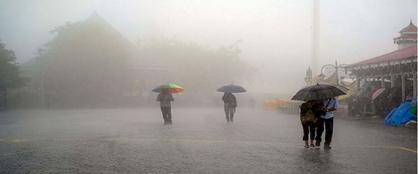
New Delhi: The India Meteorological Department (IMD) has issued a strong warning for widespread heavy to very heavy rainfall, squally winds, and extremely rough sea conditions along India’s east coast, extending from Tamil Nadu to Odisha, over the next two days. The alerts come as a developing low-pressure system over the Southeast Bay of Bengal gradually intensifies into a deep depression and heads toward coastal Andhra Pradesh. The IMD has said the system is expected to strengthen into a cyclonic storm by Monday, marking the season’s first cyclone likely to make landfall over the Indian mainland.
Once formally intensified into a cyclone, the system will be named Cyclone Montha, following the naming conventions for cyclones over the North Indian Ocean region. Earlier this month, the Arabian Sea witnessed Cyclone Shakti, but that system did not affect the Indian coastline significantly as it curved away over open waters. Cyclone Montha, however, is on track to approach populated coastal districts and is expected to bring severe weather conditions during its landfall phase.
Storm Location and Track Movement
According to IMD’s latest Saturday evening bulletin based on satellite observations and weather models, the deep depression was centered approximately:
- 620 km west of Port Blair
- 780 km east-southeast of Chennai
- 830 km south-southeast of Visakhapatnam
- 830 km southeast of Kakinada
- 930 km south-southeast of Gopalpur
The IMD forecasts that the system will continue moving west-northwestward, gaining strength as it traverses warmer sea surface waters — currently around 29–31°C, conducive for cyclone formation. By Monday, the system is expected to intensify into a cyclonic storm over the Southwest and adjoining West-Central Bay of Bengal.
Further intensification is predicted, and by Tuesday, it may strengthen into a severe cyclonic storm, approaching the north coastal Andhra Pradesh shoreline. The likely landfall point is projected between Machilipatnam and Kalingapatnam, possibly close to Kakinada, during the late evening or night hours on Tuesday.
IMD said wind speeds around the system may reach 90–110 km/h (with stronger gusts) as it nears land, especially in the core wind impact zone.
Heavy Rainfall Alerts Across States
With the system drawing moisture from the Bay of Bengal, widespread heavy rainfall will impact multiple states:
Till Tuesday: Very Heavy Rainfall (115–210 mm / 24 hours)
- Rayalaseema
- Tamil Nadu
- Kerala
- Mahe
- Coastal Karnataka
Till October 30: Heavy Rainfall (64.5–115 mm / 24 hours)
- Coastal Andhra Pradesh
- Yanam
- Telangana
- Chhattisgarh
- South Odisha
The IMD expects rainfall intensity to peak as the system reaches close to the coast, with rain bands spreading deep inland.
Red and Orange Alerts Issued
Authorities have stepped up warnings for vulnerable districts.
📍 Red Alert for Monday — Coastal Andhra Pradesh
Districts:
Kakinada, Konaseema, West Godavari, Krishna, Bapatla, Prakasam, SPSR Nellore
📍 Orange Alert for Monday — North Tamil Nadu & South Odisha
Tamil Nadu: Thiruvallur and nearby coastal belts
Odisha districts:
Malkangiri, Koraput, Kalahandi, Gajapati, Nabarangpur, Balangir, Kandhamal, Ganjam
📍 Red Alert for Tuesday — Andhra Pradesh’s northern stretch
Districts:
Srikakulam, Vizianagaram, Alluri Sitharama Raju, Anakapalli, Visakhapatnam, Kakinada, East Godavari, Eluru, Konaseema, Guntur, Krishna, Bapatla
The severe weather is likely to continue through Wednesday in some regions before weakening as the system moves inland.
Squally Winds and Rough Sea Conditions Expected
Marine warnings have been issued well in advance, with the IMD advising complete suspension of:
✅ Fishing operations
✅ Coastal tourism activities
✅ Boat and ferry services
Wind speeds could rise sharply:
| Area | Expected Wind Speed |
| Bay of Bengal (near core of cyclone) | 80–100 km/h with 110 km/h gusts |
| Andhra Pradesh coast | 50–70 km/h gusting to 80 km/h |
| Tamil Nadu and Odisha coasts | 40–60 km/h gusting to 70 km/h |
Sea conditions are forecast to become very rough to high, posing significant dangers to fishermen, trawlers, and small vessels. Ports have been alerted to halt loading/unloading of cargo during peak impact hours.
Government Preparedness in Andhra Pradesh
The Andhra Pradesh Government has initiated multiple protective measures:
- Emergency review meetings with district collectors
- Release of emergency response funds to 11 districts
- Deployment of 8 NDRF and 9 SDRF specialized rescue teams
- Declaration of school and college holidays till Wednesday
- Suspension of fishing activities along the coast
- Closure of beaches for tourists and public gathering
- Opening of medical camps and rapid-response healthcare units
- Hospitals-on-wheels planned for Kakinada region to manage emergencies
District administrations have been instructed to identify vulnerable low-lying areas and prepare evacuation shelters equipped with basic provisions such as food, drinking water, lighting, and medicines.
Odisha and Tamil Nadu Also Implement Preventive Measures
In Odisha, disaster management units are closely monitoring the expected impacts on southern districts. Local helplines have been activated, and fishing communities have been warned to secure boats well inland.
In Tamil Nadu, strong weather advisories have been issued for Chennai, Chengalpattu, Kancheepuram, and Nagapattinam coasts. District collectors have been directed to be on high readiness to handle floods and road blockages caused by waterlogging.
Potential Impact Scenarios (IMD/Experts)
Meteorological experts say the approaching cyclone could lead to:
- Urban and flash floods in coastal towns
- Fallen trees and power disruptions
- Landslides in hilly areas of Eastern Ghats
- Crop damage, especially paddy ready for harvest
- Travel disruption — road, rail, and possibly air
Farmers have been advised to secure agricultural equipment and postpone sowing or harvesting where possible.
Fishing Communities on High Alert
The cyclone trajectory passes across key fishing hubs of:
- Puducherry
- Nellore
- Machilipatnam
- Kakinada
- Visakhapatnam
- Gopalpur
Fishing unions have announced temporary suspension of deep-sea travel. Authorities have started shifting fishermen residing in temporary coastal settlements to safer shelters.
Cyclone Climatology: Why This Region Is at Risk
The Bay of Bengal is notorious for rapid storm intensification — known as explosive deepening — due to:
- Warmer water temperatures
- High humidity and moisture feed
- Favorable wind shear
October is among the peak months for cyclone activity, historically resulting in multiple severe cyclones affecting India’s east coast.
Andhra Pradesh’s October Cyclone Record
Some recent major storms during this month include:
| Cyclone | Year | Landfall Location | Impact Notes |
| Titli | 2018 | Near Palasa, Srikakulam | Very severe; major damage to Odisha & AP |
| Kyant | 2016 | Weakened near AP | Minimal impact |
| Hudhud | 2014 | Visakhapatnam | Catastrophic damage to Vizag infrastructure |
| Ogni | 2006 | Between Ongole & Machilipatnam | Heavy rain & coastal flooding |
Authorities say these historical events are guiding their preparedness strategy for Montha.
IMD Issues Public Safety Guidelines
The IMD bulletin includes Do’s & Don’ts for residents in vulnerable coastal zones:
✅ Stay indoors during strong winds
✅ Avoid travel during heavy downpours
✅ Keep essential medicines, documents and batteries ready
✅ Follow local evacuation orders without delay
✅ Stay away from beaches, ports, embankments
✅ Secure tin sheets, signboards, and loose objects
❌ Do not venture into the sea
❌ Avoid contact with power lines or flooded electric poles
❌ Do not spread rumors on social media
Air, Rail, and Road Transport Prepared for Disruptions
Airports in Visakhapatnam, Vijayawada, and Chennai are on alert for possible cancellations.
Railways are preparing for:
- Track clearance teams
- Drainage clearance near coastal lines
- Rescue trains if evacuations become necessary
National Highways Authority and local corporations have arranged earthmovers and equipment for emergency removal of uprooted trees.
Energy and Port Installations on Watch
Petroleum terminals, LNG facilities, and major ports:
- Kakinada
- Visakhapatnam
- Krishnapatnam
- Paradip
have activated cyclone-resilience protocols, including reduction of port operations and safeguarding critical infrastructure.
Power utilities are discouraging unnecessary high-voltage repairs and urging public reporting of damaged lines.
Next IMD Updates: 3-Hour Bulletins During Peak Approach
As the system intensifies, IMD will begin frequent 3-hour interval tracking:
- Storm movement
- Landfall time refinement
- Rainfall intensity zones
- Wind field expansion
- Sea conditions updates
Disaster management authorities will continue to adjust action plans based on these updates.
All Eyes on Bay of Bengal: A Critical 48 Hours Ahead
With Cyclone Montha steadily strengthening and moving toward India’s shoreline, the next two days will be crucial for eastern coastal states. Authorities advise the public to stay alert and avoid non-essential travel during intense weather phases.
Emergency control rooms have been activated across all at-risk districts, and rescue deployment along the coast suggests officials are preparing for worst-case scenarios while hoping for minimal damage.
The situation remains dynamic, and IMD will continue to provide timely warnings as the system evolves.
Related Posts

सरकारसँग ५ बुँदे सहमतिपछि चिकित्सक आन्दोलन स्थगित, देशभर नियमित स्वास्थ्य सेवा सञ्चालन गर्न आह्वान
सरकारसँग पाँच बुँदे सहमति भएपछि नेपाल चिकित्सक सङ्घले नारायणी अस्पताल घटनापछि जारी आन्दोलन स्थगित गर्दै देशभरका अस्पतालमा नियमित स्वास्थ्य सेवा सञ्चालन गर्न चिकित्सक तथा स्वास्थ्यकर्मीलाई आह्वान गरेको छ।


सरकार र डा. गोविन्द केसीबीच सातबुँदे सहमति, १६ औँ सत्याग्रह अन्त्य
नेपाल सरकार र वरिष्ठ चिकित्सक प्रा. डा. गोविन्द केसीबीच सातबुँदे सहमति भएपछि चिकित्सा शिक्षा सुधारलगायतका माग राखेर जारी १६ औँ सत्याग्रह सोमबार अन्त्य भएको छ। सहमतिमा गेटा स्वास्थ्य विज्ञान विश्वविद्यालय सञ्चालनदेखि विगतका सहमति कार्यान्वयनको अनुगमनसम्मका विषय समावेश गरिएका छन्।